Origin Story

The name Stratocumulus cumuliformis originates from Latin roots meaning "layer" (stratus), "heap" (cumulo), and "shaped" (formis), reflecting its layered yet billowy form. This species was formally defined in the 2017 International Cloud Atlas, expanding upon Luke Howard's early 19th-century cloud classification to distinguish stratocumulus clouds exhibiting pronounced vertical development and cumulus-like structure.

Classification

Belonging to the Stratocumulus genus, cumuliformis is a species that highlights the genus's variability by showing marked vertical growth and cellular structure. It is classified as a low-level cloud, typically found below 2,000 meters, and may present with varieties such as opacus (opaque), perlucidus (with gaps), or undulatus (wavy). It is coded as "SC" in aviation METAR reports, though species-level detail is not operationally encoded.

Appearance or Form

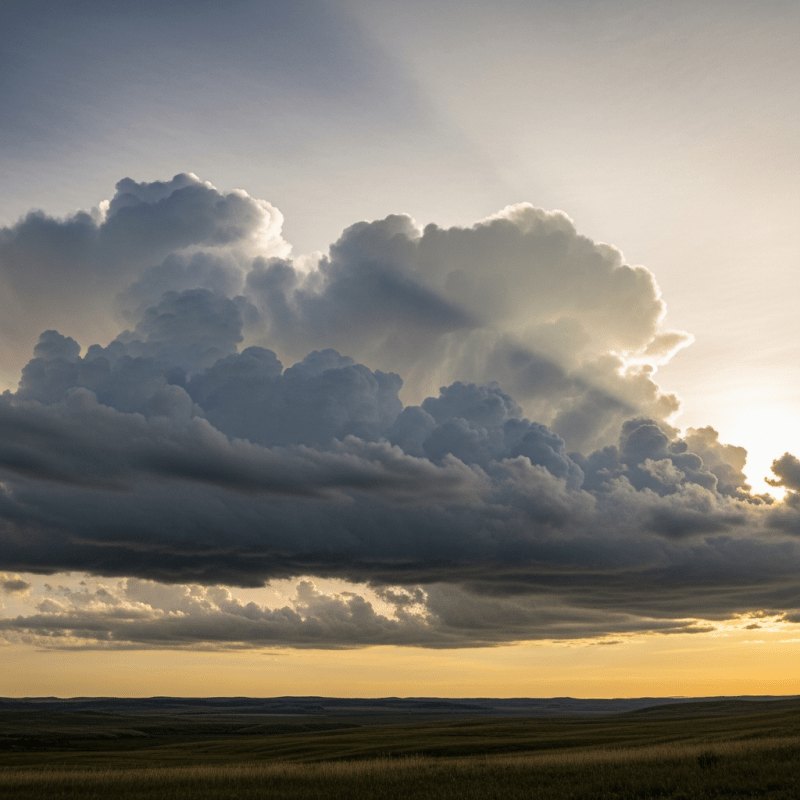
Stratocumulus cumuliformis manifests as large, heaped cloud masses with rounded, billowy tops and flat bases, usually gray or white in color. Its cellular, broken sky cover creates a textured pattern of cloud elements that often allow sunlight to filter through gaps, giving the sky a dynamic and layered visual impression.

Behavior or Usage

This cloud species forms under moderate atmospheric instability in the lower troposphere, often signaling transitional weather conditions. It plays a role in indicating low-level convective activity and boundary layer processes. For aviation, it may cause mild turbulence due to vertical air currents but generally poses minimal hazard. Meteorologists monitor it to assess evolving stability and cloud development.

Merchandise & Prints

Bring this kind into your world � illustrated posters, mugs, and shirts.

Stratocumulus cumuliformis Stratocumulus cumuliformis Poster

Stratocumulus cumuliformis Poster

Archival print, museum-grade paper

Stratocumulus cumuliformis Stratocumulus cumuliformis Mug

Stratocumulus cumuliformis Mug

Stoneware mug, dishwasher safe

Stratocumulus cumuliformis Stratocumulus cumuliformis Shirt

Stratocumulus cumuliformis Shirt

Soft cotton tee, unisex sizes

Attributes & Insights

Taxon-Specific Insights

🌍Cultural Significance

Stratocumulus cumuliformis, with its dramatic, billowy appearance, is frequently featured in weather photography and educational materials as a vivid example of cloud morphology. Its presence symbolizes changing weather and atmospheric dynamics, often inspiring artistic depictions and serving as a teaching tool in cloudspotting communities.

📌Notable Facts

  • Despite its cumulus-like form, it remains classified within the stratocumulus genus due to its layered origin.
  • It can evolve into cumulus congestus if vertical growth continues, bridging cloud types.
  • Typically produces little to no precipitation, though light drizzle is possible with stronger vertical development.
  • Common worldwide, especially over marine and coastal regions.
  • Its textured cellular pattern is easily identifiable in satellite imagery.

🌦️Formation Process Details

🌦️ Stratocumulus cumuliformis forms in the lower troposphere when moderate atmospheric instability causes stratocumulus layers to develop vertical, convective currents. This process often involves the transformation of stable stratocumulus into more heaped, cellular structures as rising air pockets create billowing cloud elements. It may also arise from the spreading and merging of cumulus clouds or the breakdown of stable cloud decks.

Visual Variations

High quality photograph of a Stratocumulus cumuliformis, belonging to the taxonomy clouds
Realistic outdoor scene featuring a Stratocumulus cumuliformis
Cross-sectional diagram of a Stratocumulus cumuliformis
Depiction of a Stratocumulus cumuliformis as seen in cultural or practical use

Composition & Context

Taxon-Specific Insights

🗺️Altitude And Distribution

🗺️ This species typically occupies low altitudes, with cloud bases ranging from 600 to 2,000 meters above ground level and tops extending up to 2,500 meters. It is widespread globally, particularly prevalent in marine and coastal climates, and commonly appears during transitional weather periods where atmospheric instability fluctuates.

⚠️Hazards And Safety

⚠️ Stratocumulus cumuliformis is generally harmless, posing minimal hazards. For aviation, it may induce mild turbulence due to vertical air movements but rarely causes significant icing or severe weather. Its light precipitation potential is limited to drizzle, presenting little risk to surface activities.

🔭Observation And Measurement

🔍 Observation of stratocumulus cumuliformis relies on visual identification of its characteristic heaped form and cellular pattern. Instruments such as ceilometers measure cloud base height, while satellites (e.g., MODIS, GOES) provide imagery to assess cloud extent and vertical structure. Surface meteorological stations contribute additional data on associated weather conditions.

🛰️Satellite Imagery Signatures

🛰️ In satellite imagery, stratocumulus cumuliformis appears as textured, cellular cloud fields with moderate reflectance in visible wavelengths. Infrared channels often reveal enhanced vertical structure, distinguishing it from flatter stratocumulus species. These signatures aid in global monitoring of low-level cloud dynamics and atmospheric stability.

Faq

Q: How does stratocumulus cumuliformis differ from regular stratocumulus?
A: It shows more pronounced vertical development and a heaped, cumulus-like form compared to flatter, more uniform stratocumulus.

Q: Can stratocumulus cumuliformis produce rain?
A: It rarely produces precipitation, but light drizzle or rain can occur if vertical growth is significant.

Q: At what altitude is this cloud usually found?
A: It typically forms at low altitudes, with bases between 600 and 2,000 meters and tops reaching up to 2,500 meters.