
Nimbostratus
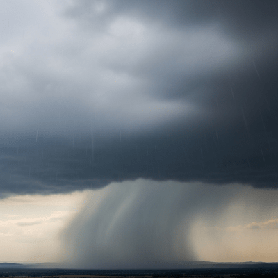
Nimbostratus is a thick, dark, and diffuse low- to mid-level cloud layer known for producing persistent, steady precipitation and often covering the sky in a uniform gray sheet that obscures the sun.
Nimbostratus is a thick, dark, and diffuse low- to mid-level cloud layer known for producing persistent, steady precipitation and often covering the sky in a uniform gray sheet that obscures the sun.
The name "Nimbostratus" combines the Latin words "nimbus" meaning rain and "stratus" meaning spread out or layered. This genus was formalized by the World Meteorological Organization, building on Luke Howard's early 19th-century classification that identified rain clouds as "Nimbus." Nimbostratus was established to distinguish rain-bearing stratiform clouds from other cloud types.
Nimbostratus belongs to the low-level cloud family and is classified as a stratiform genus. It is distinct from convective rain clouds, fitting within the broader taxonomy of clouds as a principal rain-bearing stratiform type, often associated with frontal systems and large-scale atmospheric ascent.
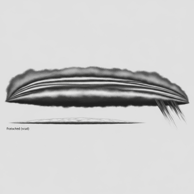
Visually, Nimbostratus appears as a thick, dark gray, amorphous cloud layer with a diffuse base and no distinct edges or features. It typically blankets the entire sky in a featureless, overcast sheet that obscures the sun, often accompanied by ragged lower cloud fragments known as pannus.
Nimbostratus functions as the primary cloud responsible for continuous, steady precipitation such as rain, snow, drizzle, or freezing rain. It plays a critical role in weather forecasting by signaling widespread, persistent precipitation and is significant in aviation for indicating reduced visibility and icing risks.
Bring this kind into your world � illustrated posters, mugs, and shirts.

Archival print, museum-grade paper
Buy Poster
Stoneware mug, dishwasher safe
Buy Mug
Soft cotton tee, unisex sizes
Buy ShirtIn culture, Nimbostratus is often associated with gloomy, rainy weather and is symbolically linked to dreariness in literature and art. Its pervasive gray presence evokes moods of melancholy and quiet persistence, reflecting its meteorological role as a steady rain cloud.
🌦️ Nimbostratus forms primarily through the thickening and lowering of altostratus or other stratiform cloud layers, often ahead of warm fronts or within large-scale ascending air masses in extratropical cyclones. It may also develop from the spreading out of cumulonimbus clouds or by the merging of stratiform clouds, resulting in a widespread, dense cloud deck that supports continuous precipitation.


🗺️ Nimbostratus typically occupies the low-level cloud family, with bases between 0 and 2,000 meters and tops reaching 3,000 to 4,000 meters. It has a global distribution but is most common in mid-latitude regions, especially in association with frontal systems and cyclones where large-scale atmospheric ascent promotes its formation.
⚠️ Nimbostratus clouds bring persistent precipitation that can reduce visibility and cause wet or icy conditions. For aviation, they present risks including icing on aircraft surfaces and minor turbulence. On the ground, steady rain or snow from Nimbostratus can contribute to flooding and hazardous travel conditions.
🔍 Nimbostratus is commonly observed through visual sky assessments and reported in weather observations. Instrumentally, ceilometers measure cloud base height, radar detects precipitation intensity, and satellites use infrared and visible sensors to identify its extensive, uniform cloud shield. Aircraft in situ sampling also contributes to understanding its microphysical properties.
🛰️ In satellite imagery, Nimbostratus appears as an extensive, uniform, and cold cloud shield in infrared channels, indicating thick cloud cover with high water content. Its low brightness in visible imagery reflects its dense, moisture-laden nature, making it distinguishable from thinner or broken cloud types.