
Lenticular cloud
Lenticular clouds are distinctive, lens-shaped clouds that typically form in the lee of mountains, recognized for their smooth, layered appearance and stationary nature.
Lenticular clouds are distinctive, lens-shaped clouds that typically form in the lee of mountains, recognized for their smooth, layered appearance and stationary nature.
The term "lenticular" originates from the Latin word lenticula, meaning "lens," reflecting the cloud's characteristic shape. Lenticular clouds were formally classified as a species within the Altocumulus, Stratocumulus, and Cirrocumulus genera in the International Cloud Atlas by the World Meteorological Organization. Their scientific recognition dates back to early 19th-century cloud classification efforts by Luke Howard, with ongoing refinements in subsequent editions of the Atlas.
Lenticular clouds are classified as the species lenticularis within several cloud genera: primarily Altocumulus lenticularis, but also Stratocumulus lenticularis and Cirrocumulus lenticularis. This places them within the mid-level cloud family, though they can appear at low and high altitudes depending on the genus.
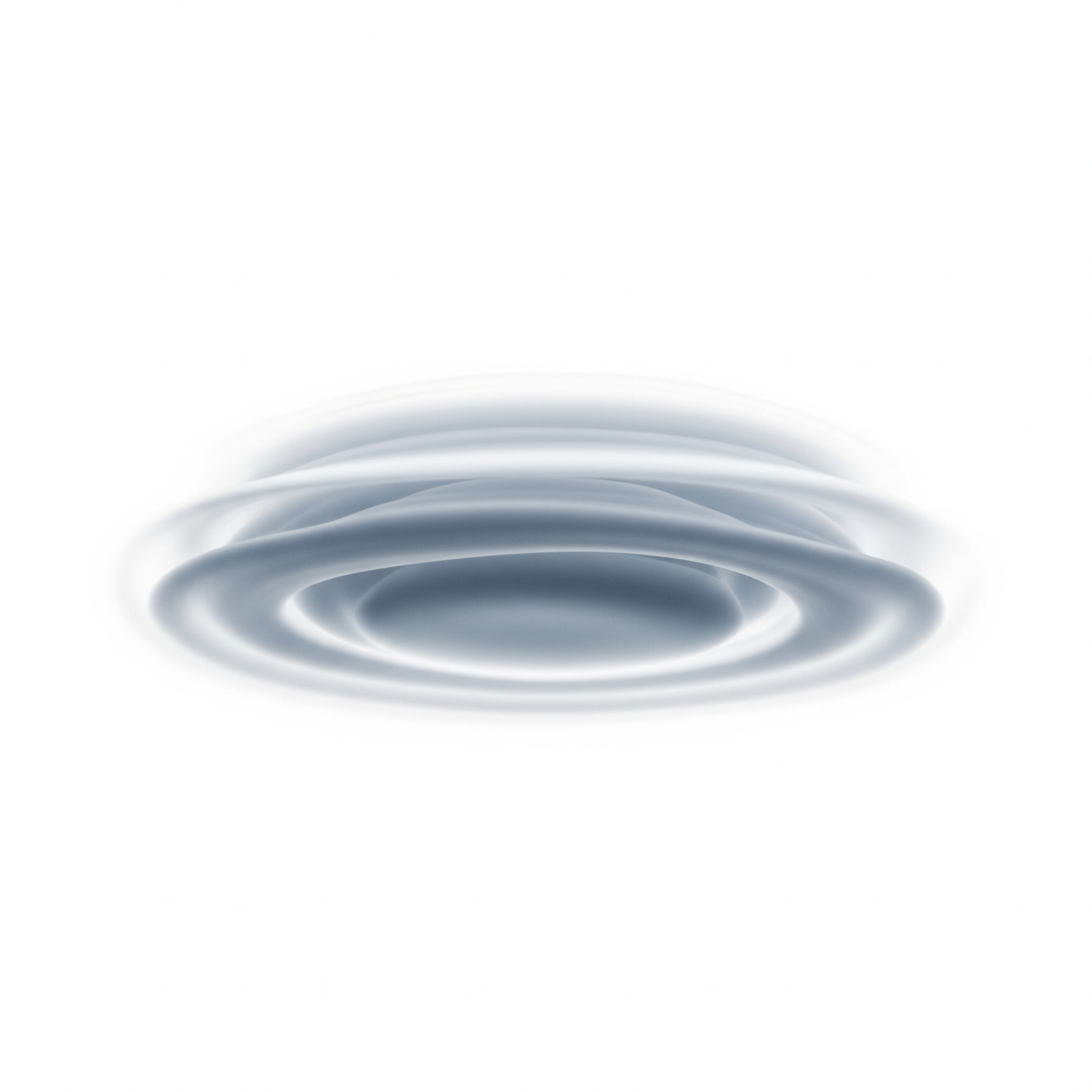
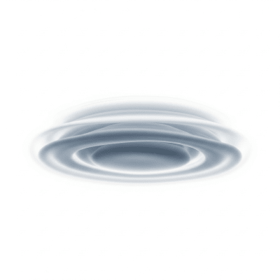
These clouds exhibit smooth, lens- or almond-shaped forms, often stacked in layered arrangements. Their edges can appear sharp or diffuse based on humidity and wind shear, with colors ranging from white to gray. Under certain lighting, lenticular clouds may display iridescence, enhancing their striking, saucer-like appearance.
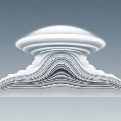
Lenticular clouds form and remain stationary as air flows through atmospheric gravity waves generated by orographic lift on the lee side of mountains. While they do not produce surface precipitation, their presence signals underlying wave activity and strong winds. Pilots and meteorologists use lenticular clouds as indicators of turbulence and mountain wave conditions, important for aviation safety and weather forecasting.
Bring this kind into your world � illustrated posters, mugs, and shirts.
Archival print, museum-grade paper
Buy Poster
Stoneware mug, dishwasher safe
Buy Mug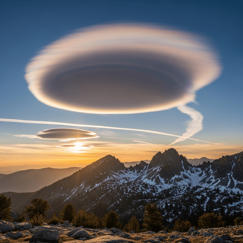
Soft cotton tee, unisex sizes
Buy ShirtFamous for their UFO-like shape, lenticular clouds have captured public imagination and frequently appear in photography and popular media. They serve as vivid illustrations of atmospheric wave phenomena in educational materials and are sometimes informally called "saucer clouds" or "UFO clouds." Their striking form has inspired artistic and cultural references worldwide.
🌦️ Lenticular clouds form when stable, moist air flows over a mountain or hill, creating atmospheric gravity waves on the lee side. As the air rises at the wave crest, it cools adiabatically, reaching saturation and condensing into cloud droplets. The cloud forms at the wave peak and dissipates as the air descends and warms, resulting in a stationary cloud that appears fixed despite continuous airflow. This process requires stable atmospheric conditions, sufficient moisture, and an orographic obstacle to generate the wave pattern.


🗺️ Lenticular clouds primarily occur at mid-level altitudes, typically between 500 and 6,000 meters at their base, extending up to 12,000 meters at their top depending on the genus. Altocumulus lenticularis generally form between 2,000 and 7,000 meters, Stratocumulus lenticularis between 500 and 2,000 meters, and Cirrocumulus lenticularis between 6,000 and 12,000 meters. They are most prevalent in mountainous regions worldwide, including the Rockies, Andes, Alps, and Japanese Alps, but can also appear over hills or areas with strong wind shear and wave activity.
⚠️ While lenticular clouds themselves do not produce precipitation, they are associated with severe turbulence caused by underlying mountain waves. This turbulence can pose significant hazards to aviation, especially for glider pilots and mountain flying. Additionally, rotor clouds and wind shear may develop beneath lenticular clouds, increasing the risk of sudden and dangerous air movements. Pilots are trained to recognize these clouds as warnings to exercise caution.
🔍 Lenticular clouds are primarily observed visually due to their distinctive shape and stationary behavior. Ground-based photography and human observation remain key methods for identification. Remote sensing techniques include satellite imagery, which captures their smooth, oval shapes; ceilometers and lidar instruments that measure vertical cloud structure; and radar systems that can detect associated atmospheric waves. These combined methods help meteorologists monitor their formation and implications.
🛰️ In satellite imagery, lenticular clouds appear as smooth, oval, or elongated white patches, often aligned perpendicular to the prevailing wind direction. They remain stationary relative to the underlying terrain, making them distinguishable from other cloud types. Visible satellite bands highlight their sharp edges and layered structure, while infrared imagery can reveal temperature contrasts associated with their altitude and phase. Their unique shape and persistence aid in remote identification of mountain wave activity.