
Cumulus humilis
Cumulus humilis is a low-level cloud species known for its small, flat, and horizontally spread appearance, commonly signaling fair weather and stable atmospheric conditions.
Cumulus humilis is a low-level cloud species known for its small, flat, and horizontally spread appearance, commonly signaling fair weather and stable atmospheric conditions.
The name Cumulus humilis originates from Latin, where "cumulus" means "heap" or "pile," and "humilis" means "low" or "humble," reflecting its modest vertical size. This species was formalized following Luke Howard's early 19th-century classification of cumulus clouds and later standardized by the World Meteorological Organization in the International Cloud Atlas to distinguish it from more towering cumulus forms.
Cumulus humilis belongs to the Cumulus genus, a primary cloud family characterized by heap-like, convective formations. Within this genus, the humilis species is identified by its limited vertical growth and flat, broad shape, setting it apart from species like congestus or mediocris that exhibit more vertical development.
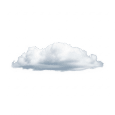
Cumulus humilis clouds appear as small, detached heaps with a distinctly flattened, horizontal shape. Their tops are rounded while their bases remain relatively flat and well-defined. Typically white or light gray, they often resemble soft cotton balls or sheep scattered across the sky, embodying the classic fair-weather cloud look.
These clouds form through localized convection under stable atmospheric layers, where warm air rises until capped by a temperature inversion that limits vertical growth. They serve as visual indicators of fair weather and minimal atmospheric instability. For aviators, their presence suggests smooth flying conditions with little turbulence or icing risk.
Bring this kind into your world � illustrated posters, mugs, and shirts.

Archival print, museum-grade paper
Buy Poster
Stoneware mug, dishwasher safe
Buy Mug
Soft cotton tee, unisex sizes
Buy ShirtCumulus humilis has long been celebrated in art and literature as the quintessential fair-weather cloud, symbolizing tranquility and pleasant skies. Often referred to colloquially as "cotton ball" or "sheep" clouds, they evoke a sense of calm and are frequently depicted in paintings and photography to represent serene outdoor scenes.
🌲️ Cumulus humilis clouds form when localized surface heating causes warm air parcels to rise through the lower atmosphere. As these parcels ascend, they cool and reach the condensation level, forming cloud droplets. However, a temperature inversion or stable atmospheric layer acts as a cap, preventing further vertical growth and resulting in their characteristic flattened, spread-out shape.


🗺️ These clouds are classified as low-level, typically forming with bases between 500 and 2,000 meters and tops up to about 2,500 meters. They occur worldwide in temperate and tropical climates, most frequently over land during spring and summer months when surface heating is strongest.
⚠️ Cumulus humilis clouds pose no direct hazards. They indicate stable atmospheric conditions with minimal turbulence and no risk of icing. Their presence is reassuring for aviation and outdoor activities, signaling fair weather and safe flying conditions.
🔍 Observation of cumulus humilis is primarily visual, relying on human identification of their distinctive shape and size. Ceilometers help determine their base height, while satellite remote sensing provides spatial distribution data. Visible satellite imagery captures their bright, scattered appearance, though infrared detection is limited due to their thin optical thickness.
🛰️ In satellite imagery, cumulus humilis clouds appear as small, bright, and scattered white patches in visible light images. Their limited vertical thickness makes them challenging to detect in infrared bands, where they often blend with the background due to low optical depth.