
Cumulonimbus capillatus
Cumulonimbus capillatus is a towering, dense cloud species characterized by a fibrous, hair-like upper portion often forming a distinctive anvil shape, signaling mature thunderstorm activity and severe weather potential.
Cumulonimbus capillatus is a towering, dense cloud species characterized by a fibrous, hair-like upper portion often forming a distinctive anvil shape, signaling mature thunderstorm activity and severe weather potential.
The name cumulonimbus capillatus originates from Latin terms meaning "heap" (cumulus), "rain cloud" (nimbus), and "having hair" (capillatus), describing its dense base and fibrous upper structure. First formally classified in the World Meteorological Organization's International Cloud Atlas, this species builds on Luke Howard's early 19th-century cloud taxonomy, reflecting advances in cloud morphology and meteorological observation.
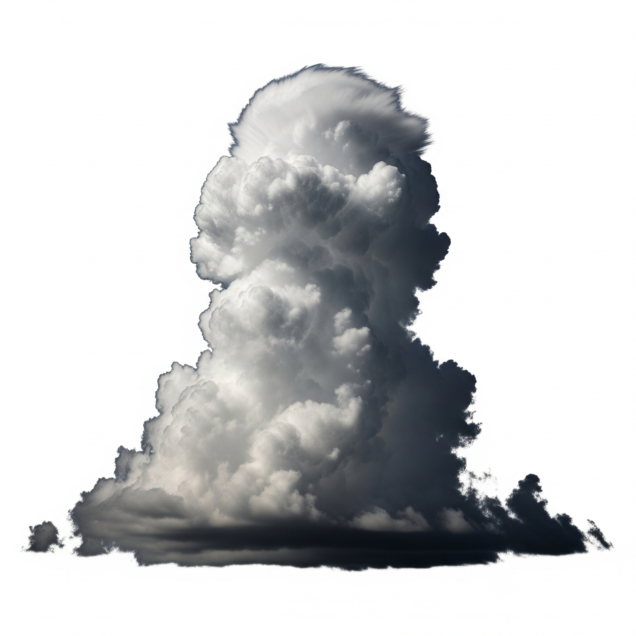
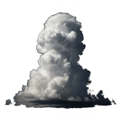
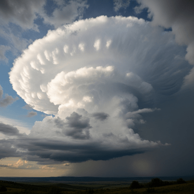
This cloud belongs to the cumulonimbus genus, known for vertical development and convective activity. The capillatus species is distinguished by its fibrous, ice-crystal-rich upper portion. It is part of the vertical altitude family, spanning from low to high tropospheric levels. Supplementary features like incus (anvil top) and mammatus often accompany it, while it commonly develops from the mother cloud cumulus congestus. In aviation, it is reported under the METAR code CB, though species-level detail is not specified.
Cumulonimbus capillatus presents as a dense, towering cloud mass with a dark, heavy base and a striking upper section marked by fibrous, hair-like ice crystal formations. Its mature stage often features a flat, anvil-shaped top (incus), spreading horizontally under upper-level winds. The cloud’s texture shifts from solid and dense at lower levels to wispy and striated above, with white and grey hues contrasting the dark base. Accessory clouds such as pannus and arcus may form beneath its main body.
This cloud species plays a crucial role in weather systems as a principal convective cloud producing severe thunderstorms. It generates heavy precipitation including rain, hail, and snow, and is often accompanied by lightning and strong winds. Its identification is vital for aviation safety, as it signals turbulence, icing, and other hazards. Meteorologists monitor cumulonimbus capillatus to forecast severe weather events and issue warnings, while climatologists study its influence on precipitation and atmospheric dynamics.
Bring this kind into your world � illustrated posters, mugs, and shirts.
Archival print, museum-grade paper
Buy Poster
Stoneware mug, dishwasher safe
Buy Mug
Soft cotton tee, unisex sizes
Buy ShirtThe dramatic silhouette of cumulonimbus capillatus, especially its iconic anvil top, has long inspired artistic and literary depictions of storms and power. Often referred to as the "thunderstorm cloud" or "anvil cloud," it symbolizes nature’s intensity and unpredictability in cultural narratives. Its imposing form features in weather folklore and modern media, evoking awe and respect for storm phenomena.
🌦️ Cumulonimbus capillatus forms through vigorous convective updrafts in unstable atmospheric conditions. It evolves from the cumulus congestus stage as moist air rapidly rises, cools, and condenses. In the upper troposphere, water droplets freeze into ice crystals, creating the fibrous, hair-like texture characteristic of capillatus. Upper-level winds shape these ice crystals into the distinctive anvil (incus) formation, signaling the cloud's mature phase.

🗺️ This species exhibits vertical development, with bases typically between 500 and 3,000 meters and tops reaching 6,000 to 13,000 meters above ground level. In tropical regions, cloud tops may extend even higher. Cumulonimbus capillatus occurs worldwide wherever strong atmospheric instability exists, most frequently in tropical, subtropical, and midlatitude zones during convective seasons.
⚠️ Cumulonimbus capillatus poses significant hazards including severe turbulence, icing, lightning strikes, hail, microbursts, and tornadoes. It is a critical aviation hazard requiring avoidance due to risks of structural damage and loss of control. On the ground, it can cause flash flooding, wind damage, and hail injuries. Awareness and early identification are essential for public safety and operational planning.
🔍 Observation of cumulonimbus capillatus combines ground-based visual reports, pilot observations, and advanced remote sensing. Satellite imagery in visible and infrared channels reveals its towering anvil and cold, ice-rich tops. Weather radar detects precipitation cores and vertical extent, while radiosonde data provide atmospheric profiles of temperature, humidity, and wind that support forecasting and analysis.
🛰️ In satellite imagery, cumulonimbus capillatus appears as bright white, cold cloud tops in infrared channels, indicating high altitude and ice content. Its distinctive anvil shape is visible in both visible and infrared images, often spreading horizontally. Overshooting tops may appear as localized cold spots above the main anvil, signaling intense convective activity.