Cumulonimbus calvus
Cumulonimbus calvus is a towering, dense cloud species characterized by a smooth, rounded dome-like top that signals an early stage of thunderstorm development before fibrous anvil features appear.
Cumulonimbus calvus is a towering, dense cloud species characterized by a smooth, rounded dome-like top that signals an early stage of thunderstorm development before fibrous anvil features appear.
The name cumulonimbus calvus originates from Latin—cumulus meaning heap, nimbus meaning rain cloud, and calvus meaning bald—reflecting its rounded, bald summit. This species was formally recognized in the World Meteorological Organization's International Cloud Atlas, building on Luke Howard's 19th-century cloud classification system, marking a transitional phase in convective cloud evolution.
Cumulonimbus calvus is a species within the cumulonimbus genus, known for vertical development through low to high atmospheric levels. It represents an intermediate stage between cumulus congestus and the mature cumulonimbus capillatus, distinguished by its lack of fibrous cirriform tops and defined by WMO standards.
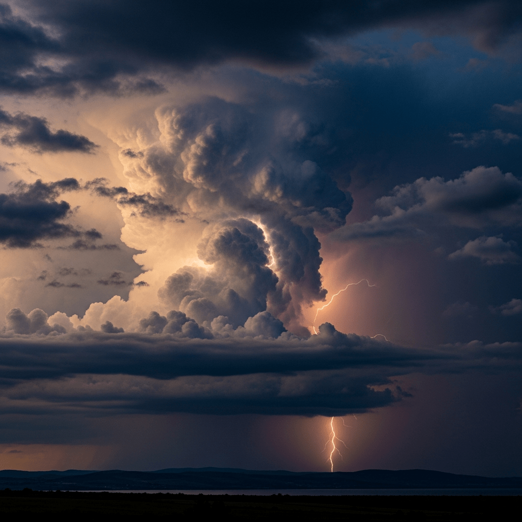
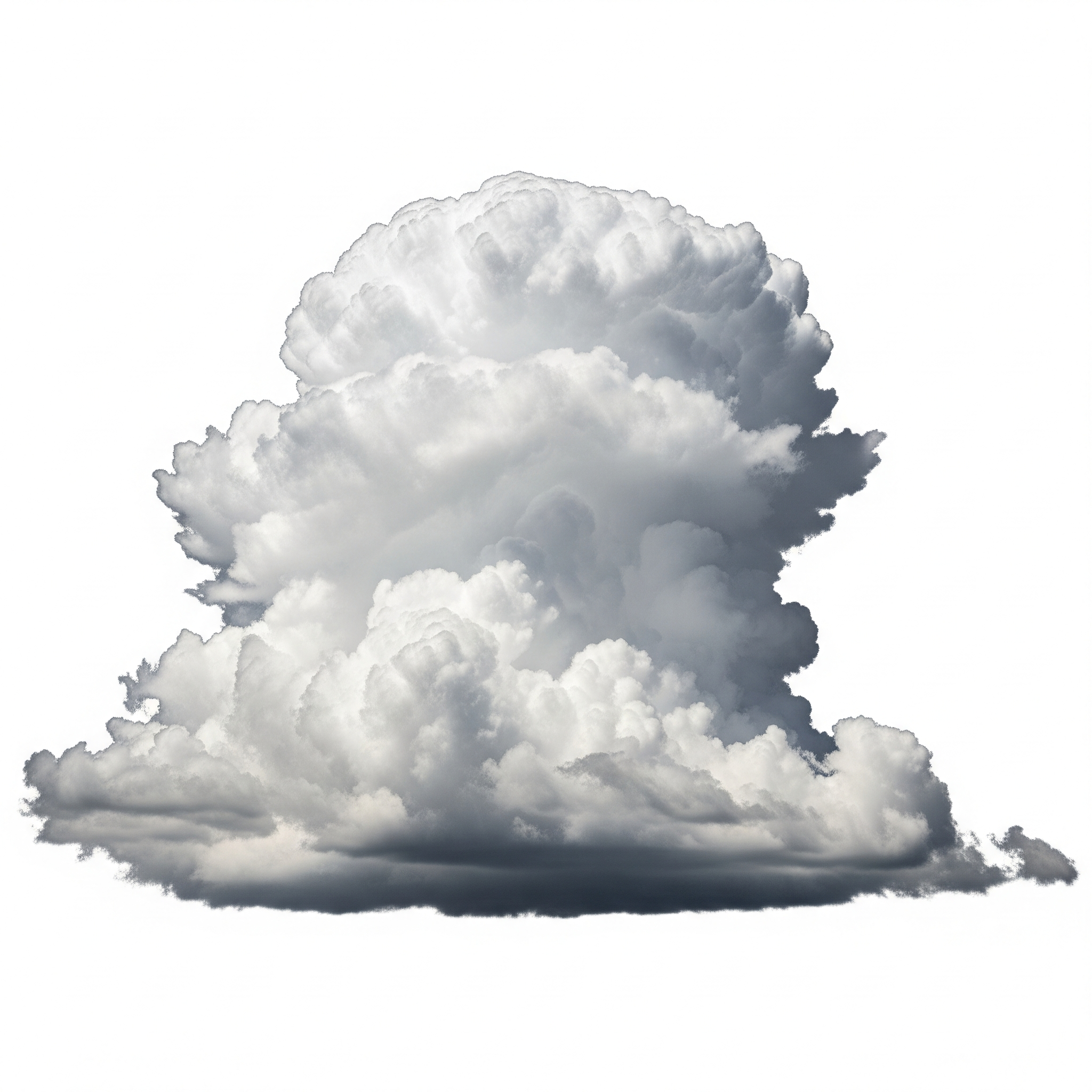
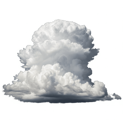
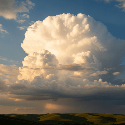
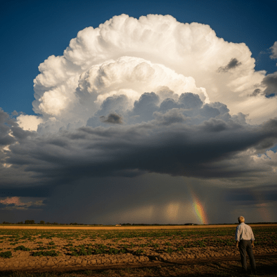
This cloud appears as a massive, vertically towering formation with a sharply outlined, rounded summit that resembles a smooth dome or cauliflower head. Its base is often dark and diffuse, while the sides show protuberances that emphasize its dense, towering nature. Colors range from bright white to dark gray depending on lighting and precipitation.
Cumulonimbus calvus forms through intense convection in unstable air masses, evolving from cumulus congestus as updrafts strengthen. It plays a critical role in weather forecasting as an early indicator of developing thunderstorms and severe weather. For aviation, recognizing this cloud is vital to avoid turbulence, hail, and lightning hazards associated with its growth.
Bring this kind into your world � illustrated posters, mugs, and shirts.
Archival print, museum-grade paper
Buy Poster
Stoneware mug, dishwasher safe
Buy Mug
Soft cotton tee, unisex sizes
Buy ShirtIn art and literature, cumulonimbus clouds often symbolize dramatic weather changes and powerful natural forces. The calvus species, with its striking dome-like form, embodies the raw energy of storms and has inspired depictions of looming thunderheads that evoke awe and anticipation.
🌦️ Cumulonimbus calvus forms through vigorous convection within unstable atmospheric conditions. Warm, moist air rises rapidly, cooling and condensing into towering cloud masses. As updrafts strengthen, the cloud grows vertically from cumulus congestus, with water droplets dominating the upper regions. Ice crystal formation is minimal at this stage, preventing the development of fibrous cirriform tops that appear later.
🗺️ These clouds span a wide vertical range, typically forming with bases between 500 and 3,000 meters and tops reaching 6,000 to 12,000 meters in mid-latitudes. In tropical regions, their vertical extent can exceed 16,000 meters. Cumulonimbus calvus is common during convective seasons across mid-latitude and tropical climates, frequently associated with thunderstorms and severe weather outbreaks.
⚠️ Cumulonimbus calvus poses multiple hazards including strong turbulence, lightning strikes, heavy precipitation, hail, and potential microbursts. These dangers make it a significant concern for aviation, where pilots must avoid its intense updrafts and possible icing conditions. On the ground, it signals the approach of severe weather requiring caution.
🔍 Observation of cumulonimbus calvus relies on visual identification of its towering, rounded form. Meteorologists use radar to assess vertical extent and precipitation intensity, while satellites detect its bright, cold cloud tops in visible and infrared bands. Aircraft in situ measurements provide direct data on microphysical properties and turbulence within the cloud.
🛰️ In satellite imagery, cumulonimbus calvus appears as bright, vertically extensive cloud masses with cold tops in infrared channels. Unlike mature cumulonimbus clouds, it lacks the distinctive anvil-shaped cirriform signature. Its smooth dome-like summit and dense vertical structure make it identifiable in visible imagery during daylight hours.