
Cirrus spissatus
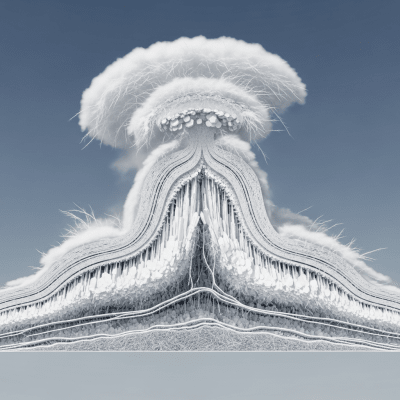
Cirrus spissatus is a dense, thick species of high-level cirrus cloud known for its ability to obscure the sun or moon, often forming from the anvils of mature thunderstorms.
Cirrus spissatus is a dense, thick species of high-level cirrus cloud known for its ability to obscure the sun or moon, often forming from the anvils of mature thunderstorms.
The name spissatus comes from Latin, meaning "thick" or "dense," reflecting this cloud's substantial optical depth compared to other cirrus types. It was formally classified in the late 19th century as cloud taxonomy evolved, with its lineage rooted in the genus Cirrus and species spissatus, as codified by the World Meteorological Organization.
Cirrus spissatus belongs to the Cirrus genus, abbreviated as Ci, and is recognized as a distinct species within this high-level cloud family. It is often associated with supplementary features like cirrus fibratus and cirrus uncinus, and typically forms as an extension or outgrowth of cumulonimbus anvils.
This cloud appears as dense, fibrous, or sometimes amorphous patches or layers, usually grayish or whitish in color. It frequently covers large areas of the sky and is notable for its opacity, often partially or completely obscuring the sun or moon.
Cirrus spissatus commonly forms from the upper portions of mature cumulonimbus clouds during or after thunderstorms. It serves as a visual indicator of active high-altitude atmospheric processes and is used operationally in meteorology and aviation to signal thunderstorm maturity and upper tropospheric moisture transport.
Bring this kind into your world � illustrated posters, mugs, and shirts.

Archival print, museum-grade paper
Buy Poster
Stoneware mug, dishwasher safe
Buy Mug
Soft cotton tee, unisex sizes
Buy ShirtIts dramatic, sun-obscuring appearance has inspired artistic and literary references as a harbinger of changeable or severe weather. Educationally, it illustrates cloud species differentiation and atmospheric dynamics, while culturally it symbolizes the power and complexity of storm systems.
Cirrus spissatus forms primarily through the spreading and thickening of ice crystals at the anvil tops of mature cumulonimbus clouds during or after thunderstorms. High-altitude winds and atmospheric dynamics cause these ice crystals to spread into dense, fibrous layers. Occasionally, other cirrus types may thicken into spissatus through ice crystal aggregation and atmospheric moisture influx.


As a high-level cloud, Cirrus spissatus typically occurs between 6,000 and 13,000 meters above ground. It has a global distribution but is most frequently observed in mid-latitude and tropical regions, especially near active convective weather systems where cumulonimbus clouds develop.
While Cirrus spissatus does not produce precipitation at the surface, it can signal the presence of mature thunderstorms and associated hazards such as turbulence at high altitudes. Its dense ice crystal layers can reduce visibility for aviation and influence radiative balance, potentially affecting flight safety and weather forecasting.
Cirrus spissatus is observed through visual cloud spotting, satellite remote sensing using visible and infrared channels, lidar profiling, and in situ aircraft sampling. These methods help characterize its morphology, altitude, and ice crystal properties.
In satellite imagery, Cirrus spissatus appears as bright, cold cloud tops in infrared bands due to its high altitude and dense ice crystals. It shows strong reflectance in visible channels, often covering extensive areas and sometimes obscuring underlying cloud features.