
Cirrostratus
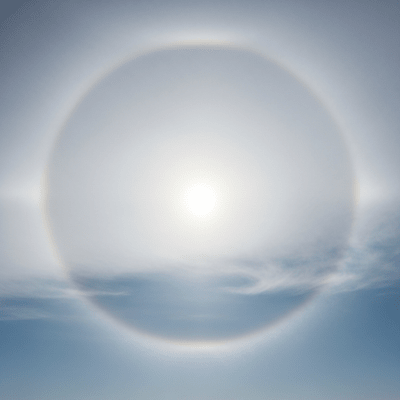
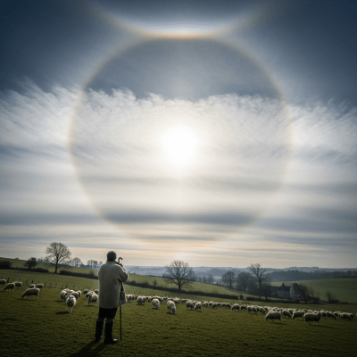
Cirrostratus is a high-level cloud genus forming thin, translucent veils of ice crystals that often cover the sky and create halo effects around the sun or moon.
Cirrostratus is a high-level cloud genus forming thin, translucent veils of ice crystals that often cover the sky and create halo effects around the sun or moon.
The name "cirrostratus" derives from Latin roots meaning "curl" and "spread out," coined by Luke Howard in the early 19th century as part of the foundational cloud classification system. Recognized as one of the ten principal cloud genera by the World Meteorological Organization, cirrostratus has maintained a stable classification since its formal introduction.
Cirrostratus belongs to the high-level cloud family and is classified as a genus characterized by extensive, sheet-like formations of ice crystals. It is distinguished from related cirrus clouds by its uniform, veil-like appearance and association with halo phenomena, fitting within the World Meteorological Organization’s canonical cloud taxonomy.
These clouds appear as thin, whitish sheets or veils that can cover large portions of the sky. Their texture ranges from smooth to fibrous, lacking distinct elements or sharp edges. The nearly transparent nature of cirrostratus often allows sunlight or moonlight to refract through ice crystals, producing striking halo effects.
Cirrostratus clouds serve as important meteorological indicators, often signaling the approach of warm fronts and impending weather changes within 12 to 24 hours. While they do not produce precipitation themselves, their presence alerts forecasters and observers to potential rain or snow from lower clouds. In aviation, cirrostratus is noted for situational awareness but poses no direct hazard.
Bring this kind into your world � illustrated posters, mugs, and shirts.

Archival print, museum-grade paper
Buy Poster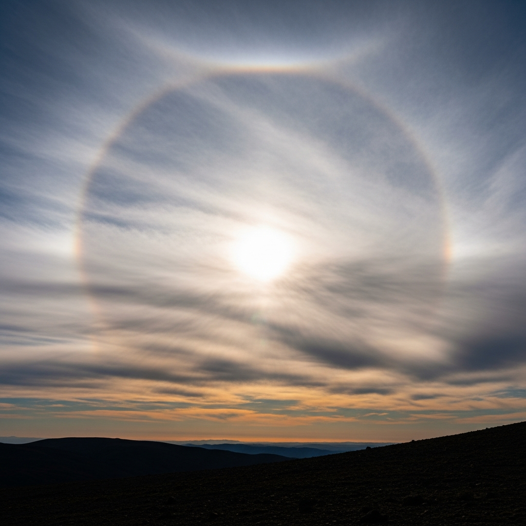
Stoneware mug, dishwasher safe
Buy Mug
Soft cotton tee, unisex sizes
Buy ShirtCirrostratus clouds have long captured human imagination through their ethereal veils and halo displays, inspiring artistic depictions and folklore. Mariners and farmers historically regarded their appearance as a sign of approaching rain, embedding cirrostratus within traditional weather lore. Today, their halos remain a popular subject in photography and skywatching culture.
Cirrostratus clouds form through the widespread ascent of moist air in the upper troposphere, usually ahead of warm fronts or large-scale cyclonic systems. As the air rises and cools, water vapor deposits directly as ice crystals, creating thin, extensive sheets or veils. These ice crystals align and refract sunlight, producing characteristic halo phenomena. The process often involves the transformation or spreading of existing cirrus clouds into more uniform layers.


Cirrostratus clouds are high-level clouds typically found between 6,000 and 13,000 meters above ground. They occur globally but are most frequent in mid-latitude regions, especially ahead of warm fronts and large-scale cyclonic weather systems. Their extensive horizontal coverage can span vast areas of the sky, often preceding changes in weather patterns.
Cirrostratus clouds pose no direct hazards to aviation or surface activities. However, their presence often indicates approaching weather changes, which may include precipitation or reduced visibility from subsequent cloud layers. Additionally, the halos they produce can affect astronomical observations by diffusing light and reducing clarity.
Cirrostratus clouds are commonly observed visually due to their distinctive veil-like appearance and halo effects. Remote sensing techniques such as satellite infrared and visible imaging detect their thin, high-altitude layers, though distinguishing them from cirrus can be challenging without halo cues. Ground-based lidar and ceilometers also measure their altitude and thickness, aiding meteorological analysis.
In satellite imagery, cirrostratus appears as thin, semi-transparent layers at high altitude. They are visible in both infrared and visible bands but can be difficult to differentiate from cirrus clouds without optical phenomena like halos. Their uniform sheet-like structure and extensive coverage help identify them in large-scale weather system observations.