
Arcus
Arcus is a striking accessory cloud type characterized by its low, horizontal, and elongated form, often appearing as dramatic shelf or roll clouds at the leading edge of thunderstorms.
Arcus is a striking accessory cloud type characterized by its low, horizontal, and elongated form, often appearing as dramatic shelf or roll clouds at the leading edge of thunderstorms.
The name "arcus" derives from the Latin word for "arch," reflecting the cloud's distinctive arched or shelf-like shape. Recognized formally as an accessory cloud in the International Cloud Atlas, arcus unifies previously regional descriptions of shelf and roll clouds under a standardized classification linked to thunderstorm outflows.
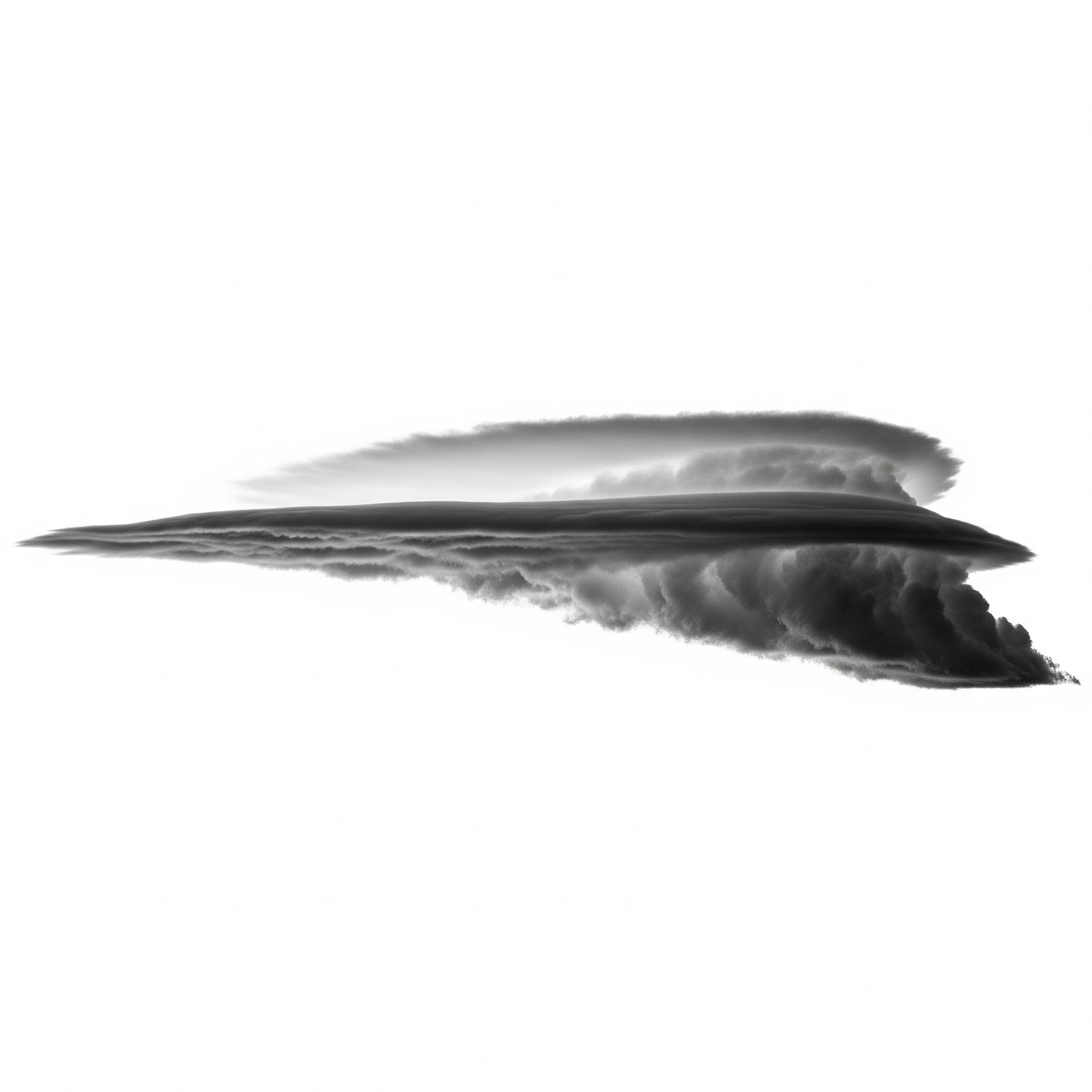
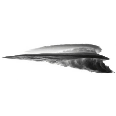
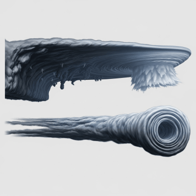
Arcus is classified as an accessory cloud genus associated primarily with cumulonimbus mother clouds. It encompasses two main forms: shelf clouds, which are attached to the parent convective cloud, and roll clouds, which are detached and exhibit a rolling motion. This genus falls within the low-level cloud family.
Arcus clouds present as low, horizontal bands with a sharply defined leading edge. Shelf clouds appear broad and wedge-shaped, featuring a turbulent underside contrasted by a smooth, often ominous upper surface. Roll clouds are tubular and detached, rolling along their horizontal axis, creating a rare and captivating visual effect.
Formed by thunderstorm outflows, arcus clouds mark the boundary where cold air pushes beneath warm, moist air, forcing it upward to condense. They serve as visible indicators of gust fronts and atmospheric instability, alerting meteorologists and the public to approaching severe weather conditions such as strong winds and turbulence.
Bring this kind into your world � illustrated posters, mugs, and shirts.
Archival print, museum-grade paper
Buy Poster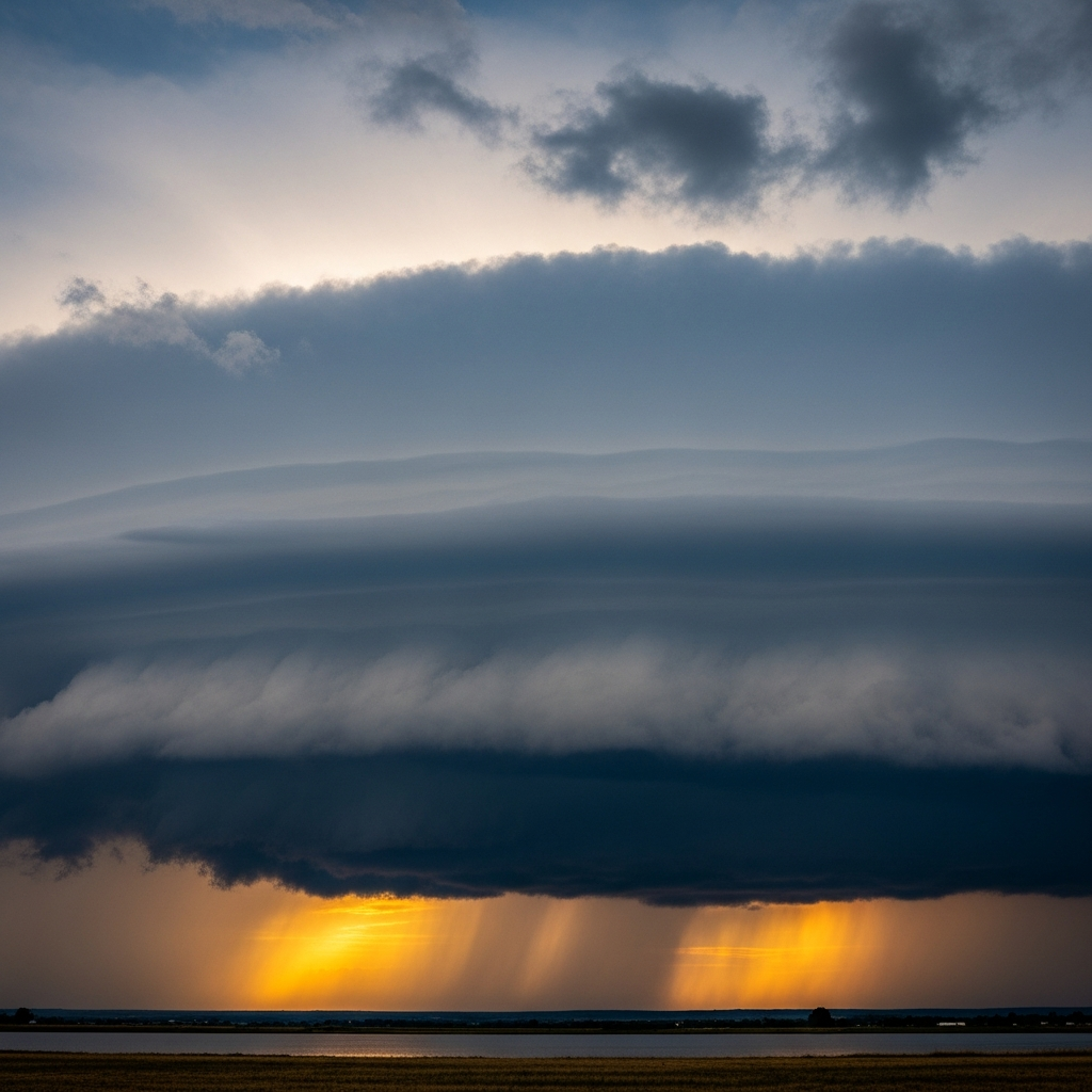
Stoneware mug, dishwasher safe
Buy Mug
Soft cotton tee, unisex sizes
Buy ShirtArcus clouds captivate photographers and weather enthusiasts with their dramatic shapes and dynamic presence. Often featured in meteorological education and popular media, shelf clouds symbolize the power of storms, while roll clouds—known regionally as "Morning Glory clouds" in Australia—have inspired local folklore and fascination.
Arcus clouds form along outflow boundaries generated by thunderstorms or convective systems. As downdrafts push cold air outward, this dense air undercuts the warmer, moist air ahead, forcing it upward rapidly. The uplift cools the air to its dew point, condensing moisture into the arcus cloud's distinctive shelf or roll shape. Shelf clouds remain attached to the parent cumulonimbus, while roll clouds form detached along advancing gust fronts, rolling due to wind shear and turbulence.


Arcus clouds belong to the low-level cloud family, typically forming from near the surface up to about 2,000 meters in altitude. They are globally distributed but most frequently observed in mid-latitude and tropical regions during convective storm seasons. These clouds often appear over land and coastal areas where thunderstorms develop.
Arcus clouds signal the arrival of strong gust fronts, sudden wind shifts, and turbulence, posing hazards to aviation and outdoor activities. Pilots must exercise caution due to potential wind shear and turbulence near these clouds. While arcus themselves do not produce precipitation, they are closely linked to severe weather events including heavy rain, hail, and tornadoes, warranting vigilance.
Arcus clouds are primarily observed visually from the ground, often documented photographically due to their striking appearance. Radar and lidar profiling help detect associated outflow boundaries and wind patterns. Satellite imagery provides contextual views of convective systems but has limited ability to resolve arcus clouds directly due to their low altitude and thin structure.
In satellite imagery, arcus clouds are challenging to identify distinctly because of their low altitude and narrow form. They may appear as thin, linear bands at the leading edge of larger convective cloud masses in visible and infrared channels, often blending with the parent thunderstorm's cloud shield.