Altocumulus
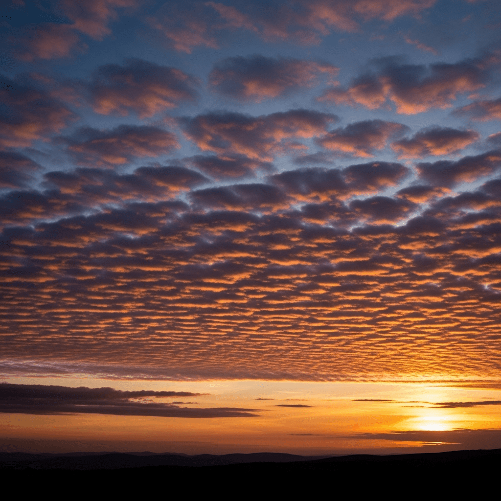
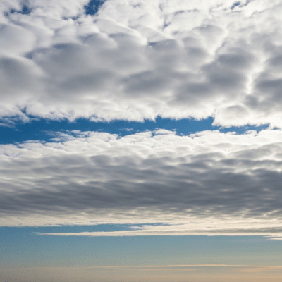
Altocumulus stratiformis is a mid-level cloud species characterized by broad, sheet-like layers of rounded cloudlets that often cover large portions of the sky in a blanket-like formation.
Altocumulus stratiformis is a mid-level cloud species characterized by broad, sheet-like layers of rounded cloudlets that often cover large portions of the sky in a blanket-like formation.
The name "Altocumulus stratiformis" originates from Latin, combining "altus" (high), "cumulus" (heap), and "stratiformis" (layered or sheet-like). This species was formally recognized by the World Meteorological Organization as part of the Altocumulus genus, building on the foundational cloud classification system established by Luke Howard in the early 19th century.
Altocumulus stratiformis belongs to the Altocumulus genus within the mid-level cloud family. It is classified as a species distinguished by its extensive, horizontally developed layers of rounded cloud elements, setting it apart from other altocumulus species by its sheet-like, widespread formation.
This cloud species appears as broad, horizontally extensive sheets composed of rounded cloudlets that may be separated or fused. The base is relatively uniform, and the cloud often presents as a white to light gray blanket with a textured, layered look. Its individual elements are larger than cirrocumulus but smaller and less vertically developed than stratocumulus clouds.
Altocumulus stratiformis forms through gentle lifting of moist, stable air in the mid-troposphere, commonly signaling atmospheric stability or the approach of a warm front. It serves as an important visual indicator for meteorologists and aviators, often marking changing weather conditions and occasionally causing mild turbulence, especially when exhibiting wave-like undulations.
Bring this kind into your world � illustrated posters, mugs, and shirts.
Archival print, museum-grade paper
Buy Poster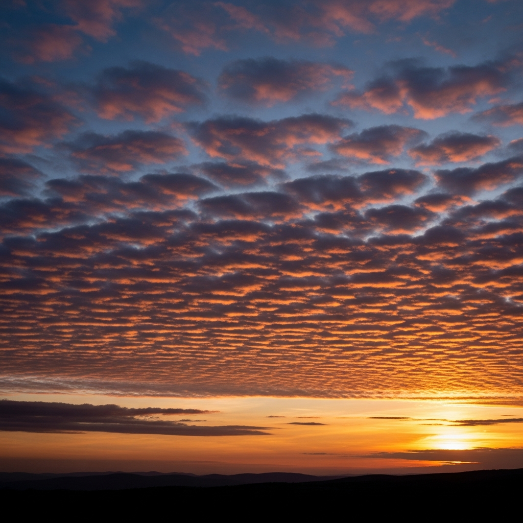
Stoneware mug, dishwasher safe
Buy Mug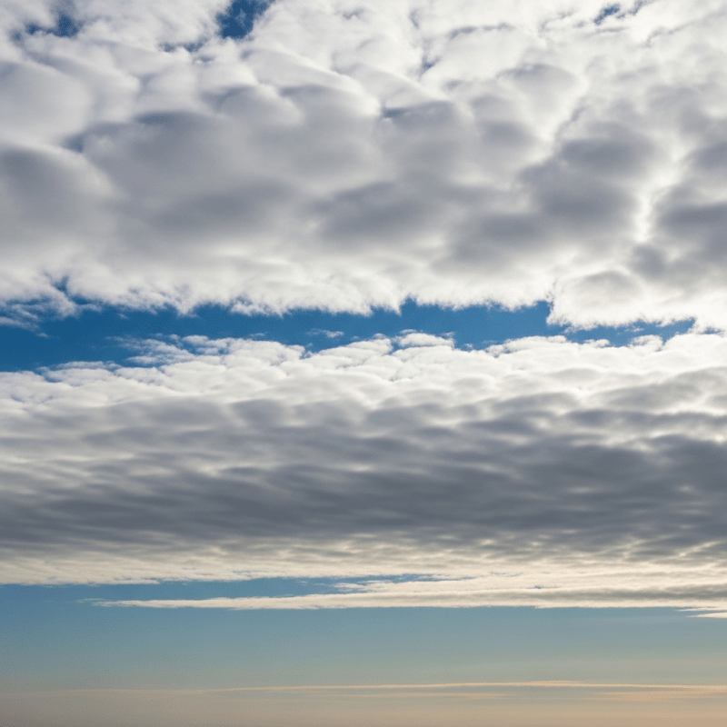
Soft cotton tee, unisex sizes
Buy ShirtIn art and literature, extensive altocumulus stratiformis formations evoke tranquil, overcast skies and have been used symbolically to represent calm and stability. Educationally, they serve as classic examples for teaching mid-level cloud identification and atmospheric processes.
Altocumulus stratiformis forms when moist, stable air in the mid-troposphere is gently lifted, often due to the approach of a warm front or in post-frontal environments. This lifting causes condensation into broad, layered sheets of rounded cloudlets. The cloud may develop from the spreading out of cumuliform clouds or through the transformation of other altocumulus species, reflecting stable atmospheric conditions with limited vertical motion.

Typically found at mid-level altitudes ranging from 2,000 to 6,000 meters above ground, Altocumulus stratiformis is widespread globally but most common in temperate regions. It frequently appears ahead of warm fronts or within stable air masses following frontal passages, marking transitional weather patterns in the mid-troposphere.
Altocumulus stratiformis is generally harmless, posing no significant precipitation or severe weather hazards. However, it can contribute to mild turbulence for aircraft, especially when exhibiting undulatus (wave-like) features. There is little to no icing risk unless supercooled droplets are present at higher altitudes, which is uncommon.
This cloud species is commonly observed visually using WMO cloud charts and identification guides. It is also studied through satellite remote sensing in visible and infrared bands, which reveal its textured, grayish-white sheet-like appearance. Additional measurement methods include ceilometers for altitude profiling and aircraft in situ sampling to analyze microphysical properties.
In satellite imagery, Altocumulus stratiformis appears as textured, grayish-white sheets with moderate reflectance in visible wavelengths. It can be distinguished from cirrocumulus by its larger, more rounded elements and from stratocumulus by its higher altitude and finer texture. Infrared imagery often highlights its mid-level temperature signature, aiding in its identification within layered cloud regimes.