
Altocumulus
Altocumulus is a mid-level cloud genus characterized by white or gray, patchy layers or sheets composed of rounded masses or rolls, often forming groups of small, puffy cloudlets arranged in regular patterns.
Altocumulus is a mid-level cloud genus characterized by white or gray, patchy layers or sheets composed of rounded masses or rolls, often forming groups of small, puffy cloudlets arranged in regular patterns.
The name "Altocumulus" originates from Latin, combining "altus" meaning "high" and "cumulus" meaning "heap" or "pile," reflecting its position above lower clouds but below higher cirrocumulus. This genus was formally described in the 19th century by Luke Howard, whose pioneering cloud classification laid the groundwork for modern meteorology. The World Meteorological Organization later codified Altocumulus in the International Cloud Atlas, establishing it as a canonical mid-level cloud type.
Altocumulus belongs to the mid-level cloud family within the WMO morphological classification system. It is distinguished from other genera by its altitude and characteristic rounded cloudlets, sitting between cirrocumulus above and stratocumulus below. Recognized species include castellanus, lenticularis, and undulatus, with supplementary features such as virga and lenticular shapes often present. It is abbreviated as "Ac" in meteorological reporting and appears in aviation codes like "AC" and "ACCAS" for castellanus species.
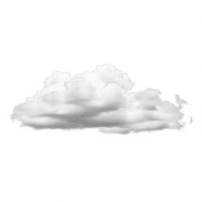
Altocumulus clouds appear as white or gray patches, sheets, or layers composed of rounded masses, rolls, or small cloudlets. These elements are larger and more distinct than cirrocumulus but smaller than stratocumulus. They often display shading and may form regular, textured patterns known as "mackerel sky." The clouds can appear puffy and layered, creating a visually striking mid-level sky cover.
Altocumulus clouds serve as important indicators of atmospheric conditions, often signaling mid-tropospheric moisture and instability. They form through the ascent and condensation of moist air, frequently preceding weather changes such as thunderstorms, especially when the castellanus species is present. In aviation, their identification helps anticipate turbulence and convective activity. They also play a role in weather forecasting and climatological monitoring.
Bring this kind into your world � illustrated posters, mugs, and shirts.

Archival print, museum-grade paper
Buy Poster
Stoneware mug, dishwasher safe
Buy Mug
Soft cotton tee, unisex sizes
Buy ShirtAltocumulus clouds are popularly known as "mackerel sky" due to their fish-scale-like pattern, a term rooted in folklore that associates their appearance with impending rain or storms. They have inspired artists and poets with their distinctive textured formations and are commonly referenced in educational materials as classic examples of mid-level cloud morphology.
Altocumulus clouds form through the ascent and condensation of moist air in the mid-troposphere, typically between 2,000 and 7,000 meters. This process is often driven by weak convection, atmospheric instability, or the approach of warm fronts. They can develop from the transformation of other cloud types such as stratocumulus or remnants of cumulonimbus anvils. Orographic uplift—air forced over terrain—also contributes to their formation. The microphysical composition primarily consists of water droplets, with supercooled droplets or ice crystals appearing at colder upper levels.


Altocumulus clouds are classified as mid-level clouds, typically forming between 2,000 and 7,000 meters above ground level. They have a global distribution, commonly observed in temperate and tropical regions, while being less frequent in polar areas. Their presence is often linked to frontal systems and pre-storm environments, reflecting atmospheric moisture and instability at mid-tropospheric levels.
Altocumulus clouds generally pose minimal hazards to surface activities. However, the castellanus species can indicate developing thunderstorms and atmospheric instability, which may lead to turbulence. For aviation, this signals potential convective activity and turbulence hazards, requiring caution during flight operations. Overall, Altocumulus rarely produces precipitation that reaches the ground, minimizing direct weather impacts.
Altocumulus clouds are commonly observed visually from the ground, where their distinctive patterns and textures are identifiable. They are also studied using satellite remote sensing in visible and infrared bands, which reveal their mid-level altitude and textured appearance. Additional measurement techniques include ceilometers for cloud base height detection and radiosonde profiling to assess atmospheric conditions conducive to their formation.
In satellite imagery, Altocumulus clouds appear as textured, patchy mid-level formations with moderate brightness and shading in visible bands. Infrared imagery typically shows brightness temperatures consistent with mid-tropospheric altitudes, distinguishing them from higher cirrocumulus or lower stratocumulus clouds. Their characteristic patterns aid in identifying atmospheric moisture and instability in weather monitoring.